Our next stop, Hallett Cove Conservation Park, which is located on the coast of Gulf St Vincent, about 22 kilometres south of South Australia’s capital city Adelaide, is one of Australia’s most outstanding geological and archaeological sites.
The park has several walking trails which describe its cultural and geological heritage, including evidence of an Australian ice age some 280 million years ago.
Hallett Cove Conservation Park is a well-preserved time capsule of the past 600 million years and a dynamic border between land and sea. The park contains one of the most important and visually interesting records of the Permian ice age. This ice age occurred about 280 million years ago when Australia was part of Gondwana, the southern super-continent which was positioned over the South Pole.
About 270 million years ago, the climate became warmer, melting the ice sheet that once covered southern Australia. Here we could see the ripples left by an ancient current. Beneath the ripples are graded beds of sediment which were deposited from these muddy currents. The overlaying slump folds were formed when the sloppy sediments moved.
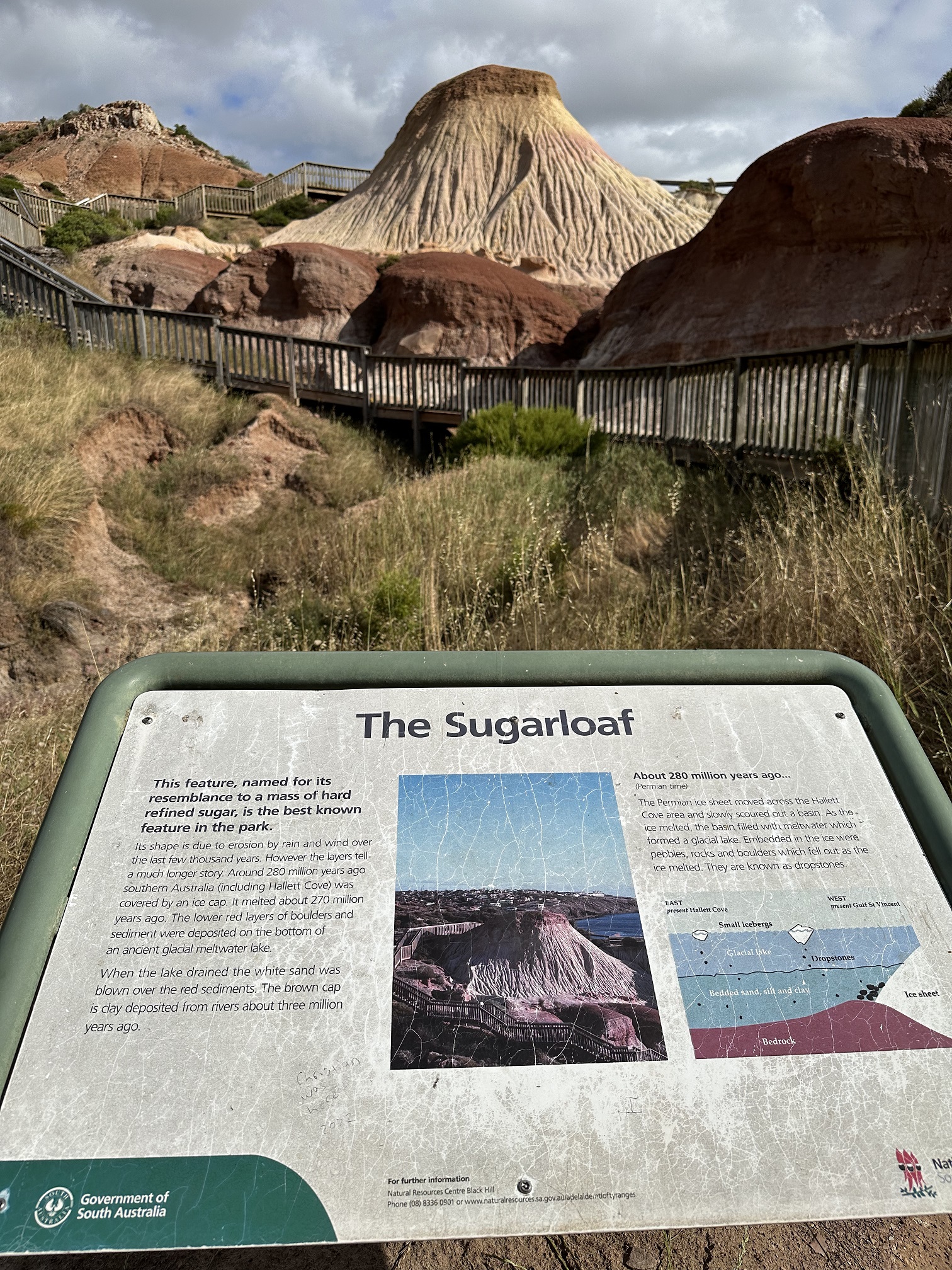
At one point, we took a turn to Sugarloaf, an iconic geological marvel of the park.
The Sugarloaf is in the area of the park called the Amphitheatre, which was once filled by a glacial lake millions of years ago. The view of the Amphitheatre Rock Formation below is simply awesome. You have to be there to see it for yourself. Photos do not do enough justice for its magnificence.
The Sugarloaf is named for its resemblance to a mass of hard refined sugar. The shape is due to wind and erosion. The red layer is made of boulders and sediment deposited on the bottom of an ancient glacial meltwater lake. When the lake was drained, white sand blew over it and settled.
The Sugarloaf is one of the main highlights in the park. We took many photos from all different angles of this incredible natural wonder.
 |
| Taken with Iphone 14 Pro |
 |
| Taken with Iphone 12 |
As we stood next to the Sugarloaf, we noticed the different colours of the sediment layers that make up the formation. Following is what I found after some research.
Base layer – The dark red layer at the base of the Sugarloaf was formed by sediments left behind by the glacial lake.
Middle layer – The middle white layer consists of light-coloured sands that replaced the ice when the glacier melted about 280 million years ago.
Top layer – At the very top of the Sugarloaf, you’ll notice another change in colour that was formed by the top soils carried by creeks and rivers from the surrounding land and Mount Lofty Ranges.
Millions of years of erosion further shaped the landscape creating the features we see today. The cycle of erosion and deposition still continues today as soils are eroded from the land and blown into the sea.
The Sugarloaf is simply amazing, regardless from which angle, near or far.
The trail actually continues further and if we walked another 1km, we would reach the Black Cliff Lookout, which was formed when a glacier moved over the landscape millions of years ago. However, we were simply too tired to take that walk.


No comments:
Post a Comment